Solving the problems associated with changes in climate conditions requires innovative tools that would effectively understand, mitigate and adapt. Satellites are a helpful tool, providing data for environmental analysis. This technology’s role in adapting to changing conditions must be considered.
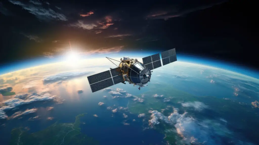
Five Types of Artificial Satellites
Devices in orbit make it possible to see things inaccessible to the naked eye. It is easier to notice changes and meaningful events from above. But that’s not all. Artificial satellites are divided into five main types, each serving a unique purpose. Let’s talk about different types of satellites and their purposes.
Communication satellites, in geostationary orbit, transmit signals over vast distances and provide global connection. Thanks to this type of space device, people can access the Internet, telephone, television and military communications.
Scientific satellites make it possible to expand humanity’s understanding of the Universe. This type of satellite is a laboratory in which astronomy is studied, and our planet is observed, exploring the mysteries of space and the place of the Earth in it.
Intelligence satellites can be called eyes in the sky, which makes it possible to collect data on the military activities of other countries and map the terrain. This type was among the first to appear, and it’s still crucial for providing national security.
It’s no secret that the Global Positioning System (GPS) exists thanks to satellites. Navigation satellites provide precise location and time data for different purposes.
Meteorological satellites monitor the atmospheric conditions of our planet. Thanks to them, humanity receives data for weather forecasting and climate research. Temperature and weather changes are observed using this type of satellite. Information obtained from meteorological space devices also helps mitigate the effects of natural disasters.
The Satellite Revolution: An Aerial View to Build Climate Resilience
The development of satellite systems and high-speed Internet access has significantly increased the volume and quality of remote sensing data. Scientists, researchers, and policymakers can utilize this information to track changes and environmental performance. Consequently, climate conditions, natural disasters, land use changes, and ecological degradation can be detected and addressed promptly. The application of various types of satellites enables accurate data-driven decisions that mitigate the effects of threats.
Adapting to climate change requires both preparing for and responding to its impacts. It involves a broad range of actions, such as fortifying infrastructure against extreme weather events and implementing sustainable agricultural practices. Reliable data is crucial for this effort, providing a bird’s-eye view of the Earth and delivering essential information for climate adaptation initiatives.
Monitoring Sea-Level Rise
Rising sea levels usually become a reason for floods and erosion. Satellites equipped with altimeters accurately measure sea level changes. Scientists and engineers can apply near real-time and historical satellite imagery to track changes and date the rate of rise in sea level.
EO devices provide researchers with valuable information about coastal ecosystems. Images from orbit make it possible to observe what changes have occurred in the height of the ocean surface and promptly detect coastal erosion. It is vital for maintaining the health of coastal communities. The data makes it possible to plan protective measures, including the construction of dams and flood protection.
Tracking Extreme Weather Events
Different types of weather satellites track storms, hurricanes and cyclones. Thus, vulnerable regions can receive timely and comprehensive information about changes, which provides early warning systems. Up-to-date data enables the allocation of resources to eliminate the consequences and mitigate damage effectively, as well as evacuate the population.
Assessing Polar Ice Cap Changes
Satellites enable observation of polar ice caps, tracking their size and melt rate. This data is crucial for comprehending ice loss’s impact on sea levels and planning future adaptations.
Remote sensing data makes it possible to study how climate change affects the Arctic ecosystem. The availability of information from orbit helps assess the status of vegetation, populations and migration of wild animals. Based on this information, conservation organizations can develop strategies to conserve the Arctic region.
Monitoring Agricultural Conditions
Satellites provide the agricultural industry with valuable information about plant health, soil conditions, weather conditions and potential threats. This data makes it possible to make effective farm management and resource allocation decisions. Technology also helps to save money and time by directing scouts to areas where problems have been identified and reducing the use of water, fertilizer and other inputs.
Mapping Urban Heat Islands
Identification of urban heat islands is also carried out thanks to satellites. It’s vital for developing urban plans and strategies for cooling vulnerable areas during heat waves. Information from space can also help to monitor heat on farms and other places affected by rising temperatures. Optical data can even reveal the land-use impacts of rising temperatures at the earth’s surface.
Assessing Forest Health
Satellite imaging has transformed the way forests are managed. Near-real-time monitoring can detect potential threats to forest health, such as illegal logging and forest fires. Remote sensing data simplifies mapping, detecting changes in vegetation and tracking wildlife populations. The technology is invaluable for protecting and preserving forests.
Predicting Droughts and Water Availability
Accurate soil moisture monitoring has many benefits, including weather forecasting, drought and flood forecasting, and disease control. Researchers can use ground stations or remote sensing techniques such as satellites to monitor soil moisture. Satellite data is a reliable source for predicting droughts and managing water resources.
Data-Driven Climate Solutions
Integrating satellite data into policymaking processes can strengthen sustainable development and help create a fairer and more sustainable world. Information received from orbit is used to study and monitor agricultural land, crop health, water availability and the health of various ecosystems. It helps define science-based policies to promote sustainable agriculture and achieve food security.
- Remote sensing data also enables innovation in climate solutions.
- Utilizing satellites as a source of valuable information will help create more accurate climate models, enhancing our ability to predict future climate trends and adapt accordingly.
- Investors and governments rely heavily on Earth observation data to prioritize adaptation projects. Thus, satellite data helps attract climate finance to vulnerable regions.
- Real-time satellite data aids in disaster preparedness and response.
- Based on satellite data, precision farming supports yield optimization and conserving resources for sustainable agriculture.
- Efforts to protect biodiversity are enhanced by satellites. Conservationists monitor and protect critical ecosystems and wildlife habitats with the help of satellite data.
Satellites have changed the way humanity responds to climate change. Technological advances enable monitoring critical events and actions and developing effective response and mitigation methods.
Related posts:

- Harnessing the Power of the Sun: A Guide to Solar Installation - February 12, 2024
- Vacuum Trucks: The Unseen Heroes of Waste Management and Their Environmental Benefits, Featuring McDonald Farms - December 11, 2023
- Satellites And Climate Adaptation: Solutions From Space - December 1, 2023